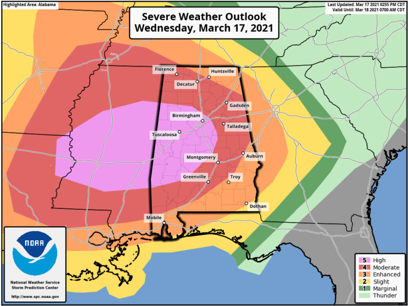
Enlarge / Severe weather outlook for Wednesday and Wednesday night. (credit: NOAA)
An extraordinarily severe weather outbreak is underway across the southern United States today, with several tornadoes already developing in Alabama. More are expected there and in nearby US states later during the day and overnight.
NOAA’s Storm Prediction Center took the step of issuing a rare “high” alert for its severe weather outlook, which it has not issued since 2019. The last time NOAA issued a “high” alert in March was 2012. At the center of NOAA’s warning area there is an exceptionally high “45 percent” contour in which a given location has a 45 percent chance of a tornado passing within 40 km.
This event is being driven by a strong upper-level trough, with an attendant surface cold front advancing across the southern United States and colliding with a warm air mass, modified by the Gulf of Mexico. Where these air masses are meeting, there are violent upward currents of air, known as updrafts, that transport moist air high into the atmosphere.


